By: Nana Appiah Acquaye
China has expanded its
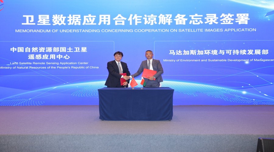
satellite remote sensing cooperation with Mauritania and Madagascar following
the signing of memoranda of understanding with institutions from the two
African countries during the 2026 China-Africa Cooperation Center on Satellite
Remote Sensing Application (CACSA) Conference Week in Beijing.
China’s National Land
Satellite Remote Sensing Application Center, under the Ministry of Natural
Resources, signed the agreements with relevant institutions from Mauritania and
Madagascar as part of efforts to deepen satellite remote-sensing application cooperation
under the CACSA framework.
The agreements mark a
further shift in China-Africa space cooperation towards practical arrangements
involving satellite data, technical expertise, institutional capacity building
and applications designed to address national development priorities.
The development was among
the key outcomes of the CACSA Conference Week, held in Beijing from September
15 to 18, which brought together government officials, space-agency
representatives, scientists and technical experts from 23 African countries,
alongside international organisations, diplomatic missions and Chinese
institutions.
The 4th Symposium on
China-Africa Satellite Remote Sensing Application Cooperation, held on
September 15 and 16, provided a platform for African countries to share
national experiences in Earth observation and examine the application of
satellite-derived information to agriculture, land administration, water
management, environmental protection, disaster preparedness, urban development
and natural-resource management.
Madagascar shared its
experience in using Chinese satellite data for national mapping, while
Mauritania presented its work in national mapping, cartography and geographic
information. Both presentations featured in the official symposium programme.
The exchanges demonstrated
how satellite remote sensing is increasingly being applied beyond space-related
activities to support practical development needs, including mapping,
environmental monitoring, resource management and planning.
Organisers reported that
representatives from 23 African countries participated in the wider CACSA
Conference Week.
The delegate information and
official symposium programme identified countries including Algeria, Burundi,
Cabo Verde, Cameroon, Comoros, Côte d’Ivoire, Egypt, Equatorial Guinea,
Ethiopia, Gabon, Ghana, Kenya, Madagascar, Mauritania, Nigeria, Rwanda, Senegal,
Somalia, Tanzania, Uganda, Zambia and Zimbabwe among those represented across
the available records.
The participation of the
African countries provided an opportunity for institutions across the continent
to exchange experiences on Earth observation and explore opportunities for
stronger cooperation with Chinese partners.