Kenya launches CroME Initiative to boost agriculture with space technology and AI
Date: 2026-02-13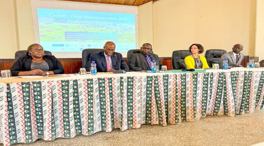
By: Nana Appiah Acquaye
Kenya
has officially launched the Crop Measurement and Evaluation (CroME) Initiative,
a project designed to enhance agricultural decision-making using satellite
imagery and artificial intelligence. The launch took place at the Kenya
Agricultural and Livestock Research Organization (KALRO) Headquarters on 10–11
February 2026.
CroME
will generate comprehensive national agricultural data, including crop maps,
growth monitoring, field boundaries, and yield predictions. The system will
also detect crop damage and support early warning mechanisms during disasters,
providing vital information for farmers, agribusinesses, insurers, and
government agencies.

The
initiative is a collaborative effort between the Kenya Ministry of Agriculture
and Livestock Development, Microsoft AI for Good Lab, NASA Harvest, and other
public and private stakeholders. Kenya’s Special Envoy on Technology,
Ambassador Philip Thigo, highlighted that AI-driven geospatial models and Earth
observation data will enable accurate crop mapping, identification, and yield
forecasting to support informed decision-making across the sector.

Maj
Gen (Rtd) Ambassador Joff Otieno Makowenga, Chairman of the Kenya Space Agency
Board, emphasized the role of space technology in advancing the government’s
Bottom-Up Economic Transformation Agenda. He noted that timely and precise data
from CroME will strengthen national food security and disaster risk management
while improving overall agricultural productivity.