By: Nana
Appiah Acquaye
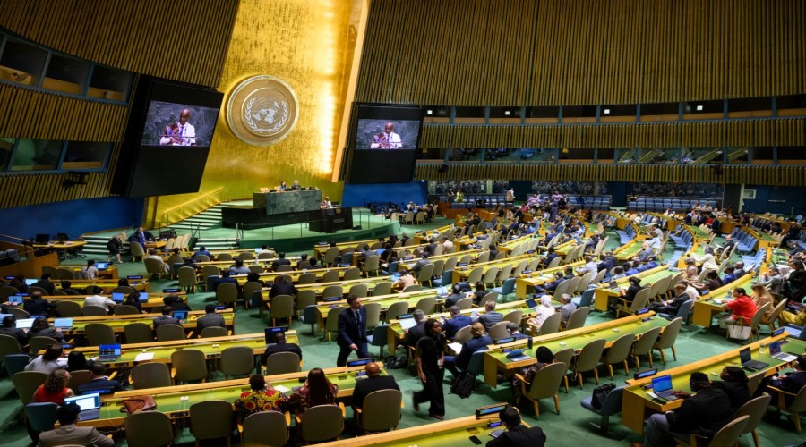
The United Nations General
Assembly has adopted an African-led resolution calling for more accurate and
equitable cartographic representation of the world’s regions, with particular
attention to Africa.
The resolution, titled
“Correct the Map: Rebalancing Global Cartographic Representation and Promoting
Equitable Representation of the World’s Regions, Particularly Africa,” was
adopted on September 4, 2026, by 164 votes in favour, one against and six abstentions.
The initiative was led by Togo on behalf of the African Group and the African
Union.
The resolution highlights
the importance of geospatial information and cartography in shaping how
territories, peoples and continents are perceived and understood. It argues
that inaccurate representations of the relative size of continents can
influence educational and public understanding of global geography.
Beyond cartographic
representation, the resolution recognises the essential role of the UN
Committee of Experts on Global Geospatial Information Management (UN-GGIM) in
using geospatial information as a foundation for effective governance,
evidence-based decision-making and sustainable development.
It also highlights the need
to strengthen national geospatial strategies and capabilities, particularly in
developing countries, and encourages North-South, South-South and triangular
cooperation in mapping and geospatial information.
The General Assembly called
for greater capacity building in developing countries in cartography,
geomatics, geodesy and geospatial technologies through technical assistance,
training, knowledge sharing, technology transfer and improved access to geospatial
data and national geospatial information infrastructure. African countries,
least developed countries, landlocked developing countries and small island
developing states were specifically identified.
The resolution encourages
the use of cartographic projections that more accurately communicate the
relative size of continental landmasses for educational and awareness purposes.
The UN Office of the Special Adviser on Africa noted that the resolution encourages
the use of equal-area projections such as Equal Earth where relative size is
important, while not banning the Mercator projection.
The debate also emphasised
that the initiative is not intended to affect national sovereignty, territorial
integrity, internationally recognised borders or the legal status of disputed
territories. Several countries, including the European Union, Canada, Australia
and New Zealand, stressed these limitations in their explanations of vote.
Togo’s Foreign Minister
Robert Dussey said the issue goes beyond mapmaking, arguing that maps influence
education, imagination and collective perceptions. The resolution’s proponents
presented more accurate representation as a matter of scientific and educational
accuracy as well as what they described as cognitive justice and historical
memory.
The resolution also places
geospatial capacity development on the General Assembly’s future agenda,
including the promotion of accurate cartographic representation for educational
and socioeconomic purposes and increased technical assistance for developing
countries.
The adoption gives African
countries a stronger platform to advance geospatial capacity, mapping expertise
and access to accurate geographic information while reinforcing the importance
of African participation in global geospatial governance.